- Home
- Trails
- Gloucester
- Dykes Pond Loop
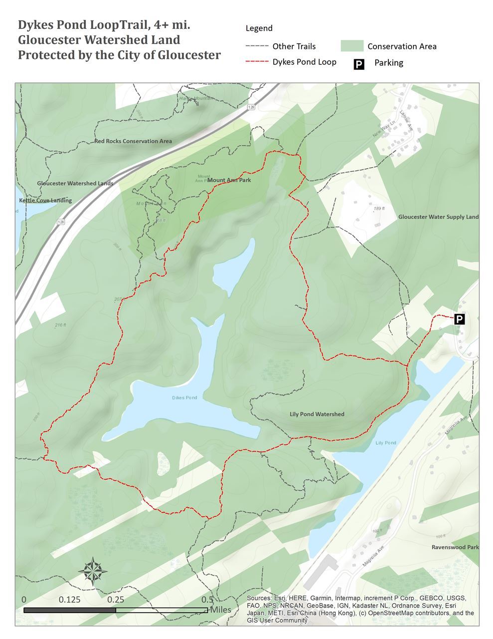
Dykes Pond LoopPermanently protected by the City of Gloucester. Trail Difficulty: moderate to difficult Length: 4+ Miles Description: This 4+ mile hike circumnavigates the City of Gloucester’s Dykes Pond Reservoir. It is a single track for the most of the its length. The last section runs along the access road to the dam, following along the shore of Lily Pond. There are several steep sections that are moderately difficult. This trail intersects with the access trail to the Trustees of Reservations Mount Ann Reservation. For historical context, The Gazetter of Massachusetts from 1889 (written to provide concise topographic records of towns and cities within Massachusetts), references for Gloucester the current Dykes Pond as "Dikes Meadow Pond." We can assume this comes prior to the construction of the dam and Route 128. Directions: Walk past the open pipe gate along the access road. After you pass the section gate (usually closed), look for a trail marker on the right hand side of the access loop. Follow markers around the reservoir in either direction. The opposite direction requires the hiker to pass the first trailhead on the right and continue towards the dam. Just before the dam look for the same trail markers on the left and enter there. Going in this direction you will cross over the dams overflow spillway and then bare right along its side for 100-150 feet to the trail.
| Parking & AccessFrom the intersection of Route 133 and Laurel Street in West Gloucester, follow Laurel Street roughly 1/2 mile to pull off on the right hand side of the road with parking for 6-8 cars.
|